
Website development on CMS WordPress for the PlanGromad platform
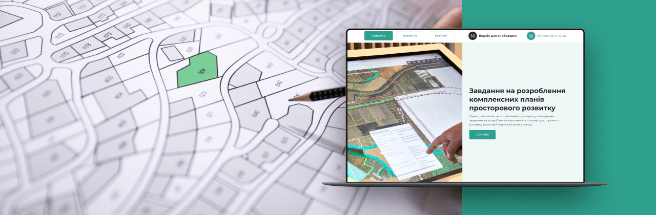
Description
The portal was developed thanks to the support of the American people, provided through the United States Agency for International Development (USAID) as part of the USAID Program for Agricultural and Rural Development (AGRO), which is implemented by Chemonics International. The opinion of the authors does not necessarily represent the official point of view of USAID or the US Government.
Tasks
Goal: To develop a unique service based on CMS WordPress, aimed at helping territorial communities in the development of geospatial development plans and providing expert advice.
Project development process
Phase 1: Analysis and Planning
Analysis of Needs:
- Thorough analysis of the target audience and their needs.
- Defining the main functions and capabilities of the platform.
Definition of Goals:
- Defining the goals of the site: providing information, assistance in developing development plans, consultations.
Creating a Plan:
- Defining the structure of the site: main page, personal account, online form, community directories.
- Development of a design plan, color palette and style.
Phase 2: Design and Development
Project UI/UX:
- Design development with a focus on ease of navigation and increased user interaction.
- Creation of design of questionnaires, personal account, tips, error messages and feedback forms.
Functionality:
- Development of functionality for creating and filling out questionnaires by users.
- Setting up the admin panel for editing questionnaire blocks and downloading guides.
- Adding a personal account with online forms and the ability to download documents.
- Loading community directories into the database.
Layout and Development:
- Design layout based on WordPress CMS using HTML, CSS and other technologies.
- Implementation of online forms for questionnaires and other functions.
- Implementation of formulas to control the correctness of filling out the form by users and display the appropriate prompts.
- Creating a scale for filling out the form in % and implementing a formula for calculating the filling out of the questionnaire based not only on the number of filled-in blocks, but also on the completeness of filling out the answers.
- Development of the backend for saving data and uploading documents.
Phase 3: Testing and Launch
Testing:
- Testing of all functions and capabilities of the site on different devices and browsers, from different accounts.
- Checking the correctness of the questionnaire and the possibility of uploading documents.
Launch and Update:
- Running the site on a live server.
- Constant support, updating and improvement of the site taking into account the needs of users and the site administrator.
Results
A platform based on CMS WordPress with a unique design has been developed, which helps territorial communities in developing geospatial development plans and providing consultations.
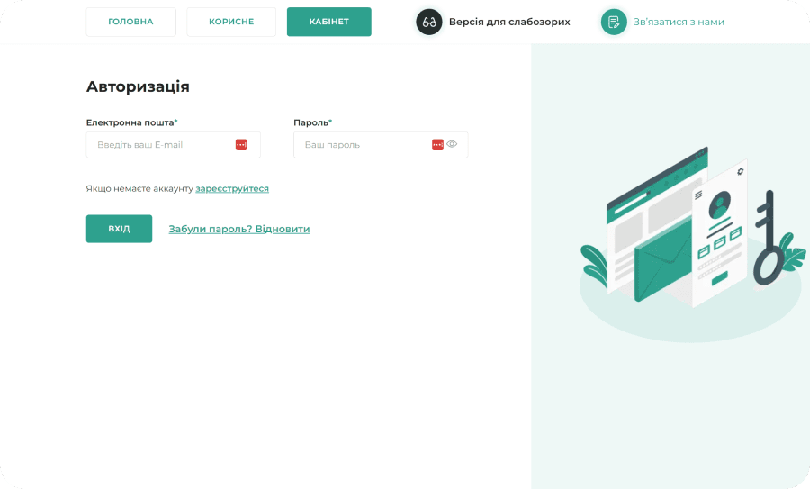
The platform has a personal account that contains a number of questions (online form), filling which the user receives the necessary legal assistance.
Also, various community directories are uploaded to the site, which help to make correct answers in the questionnaire.
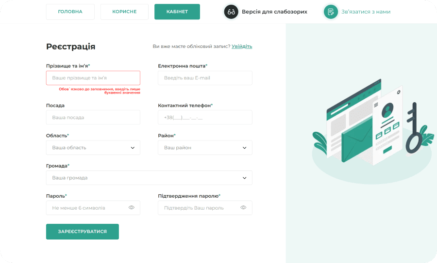
The structure of the online form is logically designed so that the data filled in by the user complies with certain rules: the dates in different blocks are correct, the names of communities and their activities are correct, etc. This helps the user to get the correct information. The personal account contains advanced user data and step-by-step completion of tasks with hints and recommendations at each stage.
The user has the opportunity to upload files to the site in the format pdf, jpg, doc, png, tiff, geodata - geotiff, geojson, shp, kml and download the questionnaire from the site in pdf, doc format.
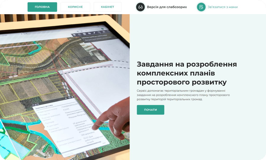
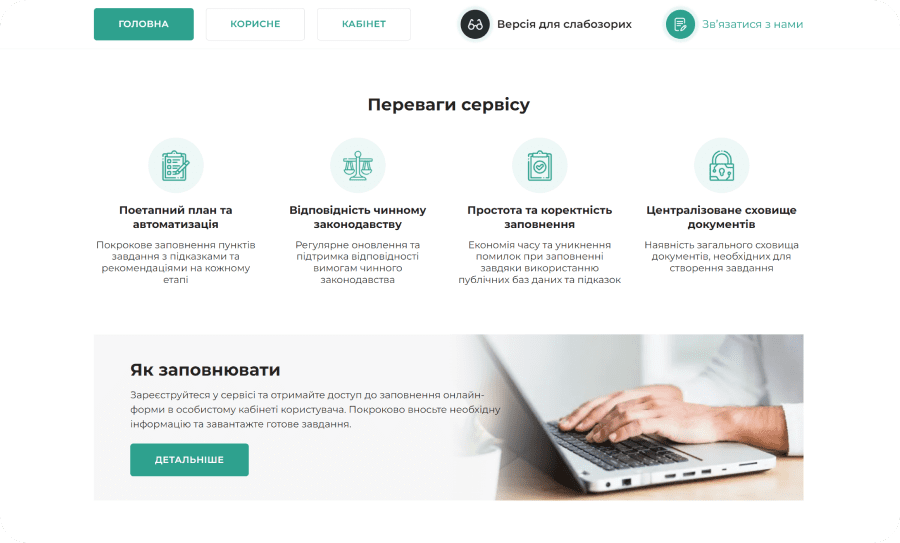
Homepage:
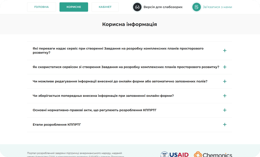
Useful information page:
Personal account:
It's free and takes 2 minutes. There are 1500+ digital agencies in the catalog that are ready to help in the implementation of your tasks. Choose and save up to 30% on time and budget!








Description
The portal was developed thanks to the support of the American people, provided through the United States Agency for International Development (USAID) as part of the USAID Program for Agricultural and Rural Development (AGRO), which is implemented by Chemonics International. The opinion of the authors does not necessarily represent the official point of view of USAID or the US Government.
Tasks
Goal: To develop a unique service based on CMS WordPress, aimed at helping territorial communities in the development of geospatial development plans and providing expert advice.
Project development process
Phase 1: Analysis and Planning
Analysis of Needs:
- Thorough analysis of the target audience and their needs.
- Defining the main functions and capabilities of the platform.
Definition of Goals:
- Defining the goals of the site: providing information, assistance in developing development plans, consultations.
Creating a Plan:
- Defining the structure of the site: main page, personal account, online form, community directories.
- Development of a design plan, color palette and style.
Phase 2: Design and Development
Project UI/UX:
- Design development with a focus on ease of navigation and increased user interaction.
- Creation of design of questionnaires, personal account, tips, error messages and feedback forms.
Functionality:
- Development of functionality for creating and filling out questionnaires by users.
- Setting up the admin panel for editing questionnaire blocks and downloading guides.
- Adding a personal account with online forms and the ability to download documents.
- Loading community directories into the database.
Layout and Development:
- Design layout based on WordPress CMS using HTML, CSS and other technologies.
- Implementation of online forms for questionnaires and other functions.
- Implementation of formulas to control the correctness of filling out the form by users and display the appropriate prompts.
- Creating a scale for filling out the form in % and implementing a formula for calculating the filling out of the questionnaire based not only on the number of filled-in blocks, but also on the completeness of filling out the answers.
- Development of the backend for saving data and uploading documents.
Phase 3: Testing and Launch
Testing:
- Testing of all functions and capabilities of the site on different devices and browsers, from different accounts.
- Checking the correctness of the questionnaire and the possibility of uploading documents.
Launch and Update:
- Running the site on a live server.
- Constant support, updating and improvement of the site taking into account the needs of users and the site administrator.
Results
A platform based on CMS WordPress with a unique design has been developed, which helps territorial communities in developing geospatial development plans and providing consultations.
The platform has a personal account that contains a number of questions (online form), filling which the user receives the necessary legal assistance.
Also, various community directories are uploaded to the site, which help to make correct answers in the questionnaire.
The structure of the online form is logically designed so that the data filled in by the user complies with certain rules: the dates in different blocks are correct, the names of communities and their activities are correct, etc. This helps the user to get the correct information. The personal account contains advanced user data and step-by-step completion of tasks with hints and recommendations at each stage.
The user has the opportunity to upload files to the site in the format pdf, jpg, doc, png, tiff, geodata - geotiff, geojson, shp, kml and download the questionnaire from the site in pdf, doc format.
Homepage:
Useful information page:
Personal account: